ubcarts.ca portfolio
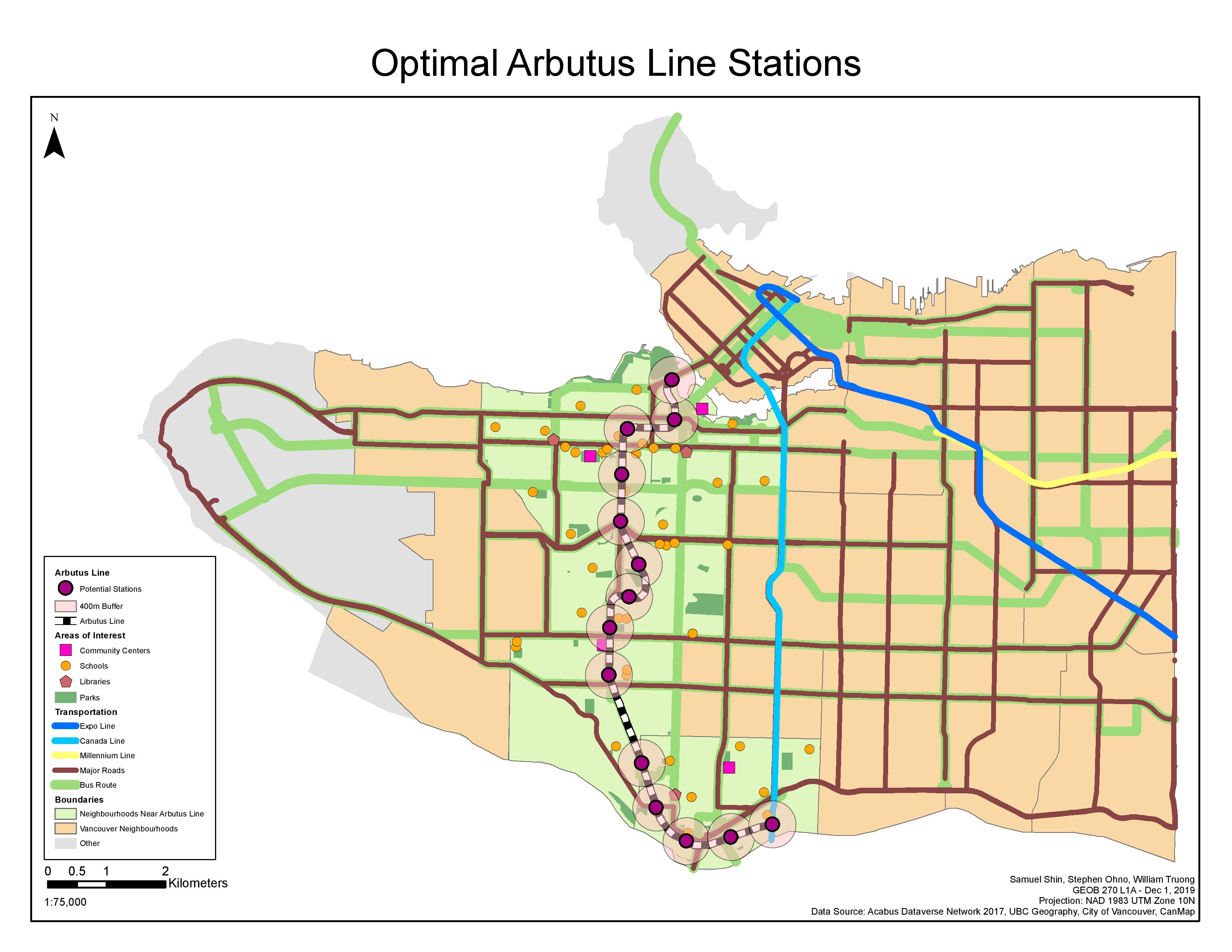
Within this project, our group set out to determine the feasibility of creating a fast-transit system on the Arbutus Corridor. This was a plan set out in 2016 for the city to incorporate a light rail into the corridor, and in our project we wanted to consider the potential locations in which a station could be placed in its most optimal point.
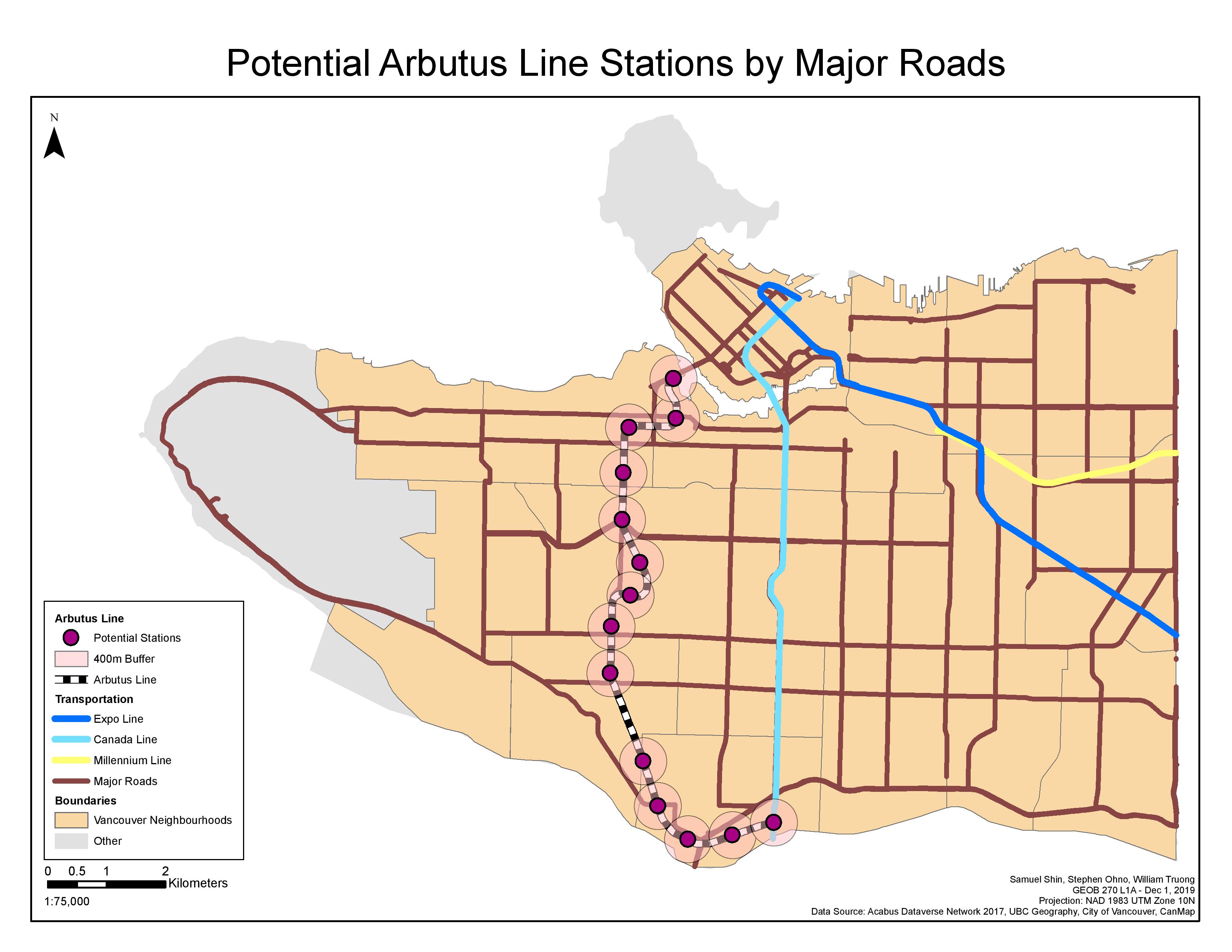
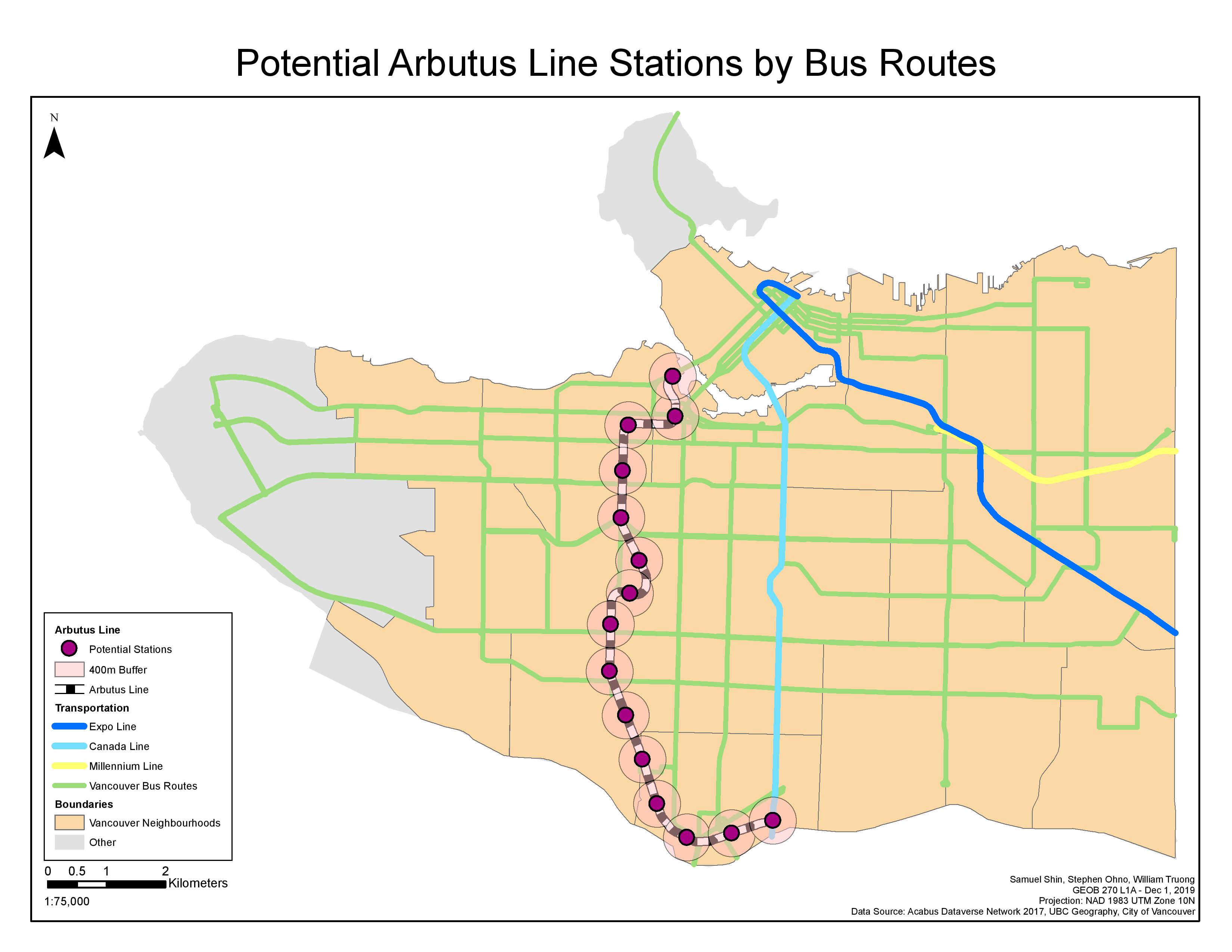
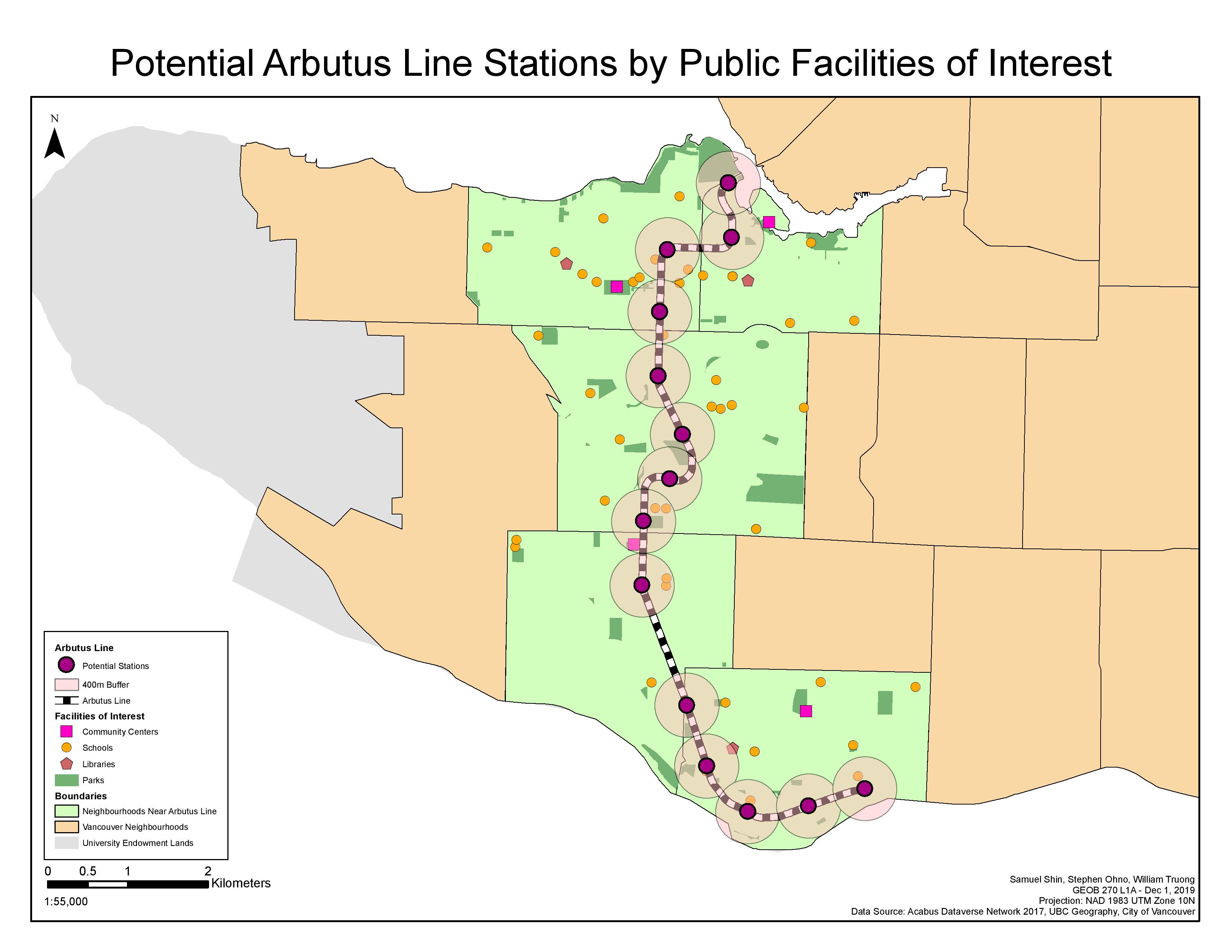
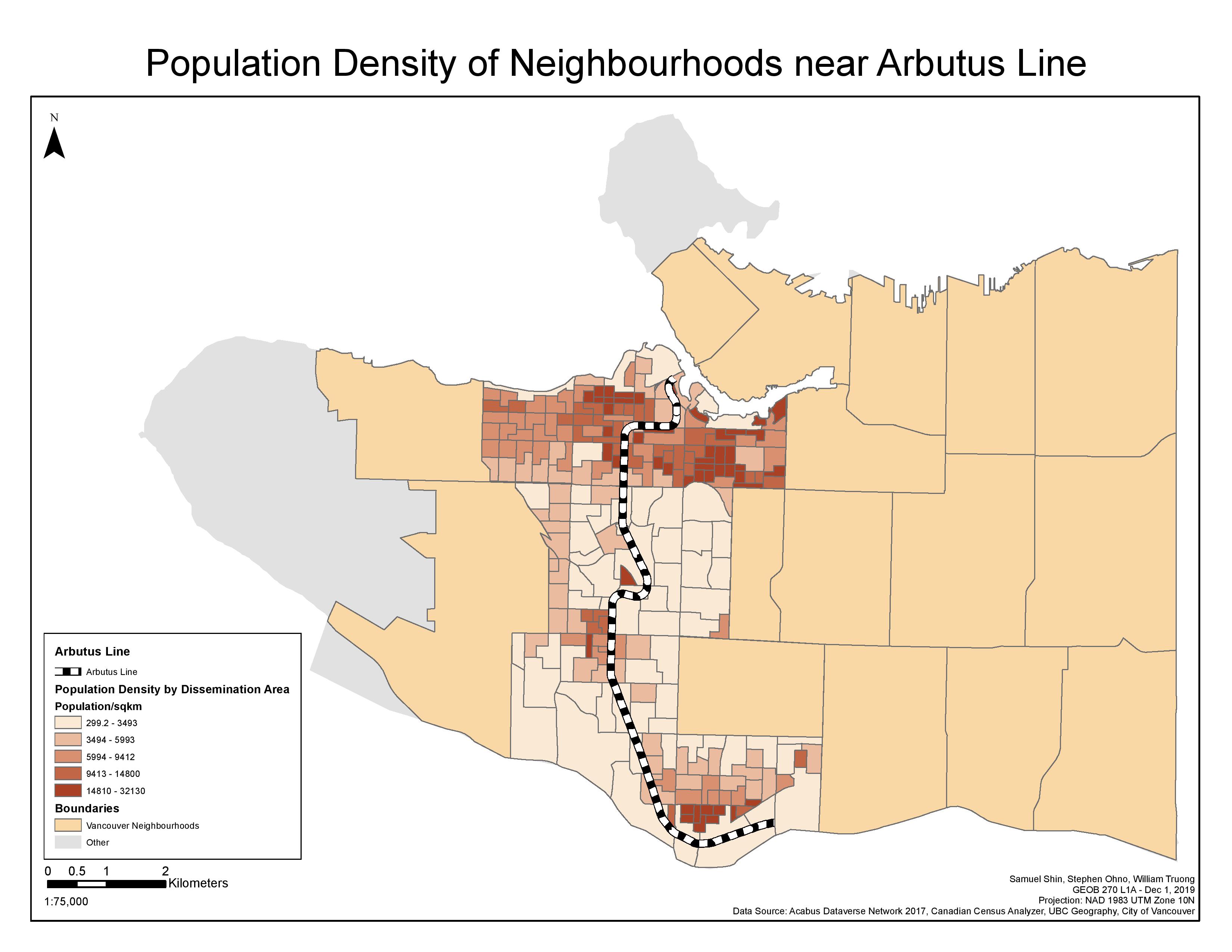
Within our project on the Arbutus corridor fast-transit system, our goals were to pinpoint the most optimal location for stations to be built on a potential new-transit system. In doing so, we analyzed for intersect of major roads and bus lines which intersected the existing arbutus corridor and the rail line which existed at the time. Through this we found 14 potential stations to be considered when conceptualizing the building of the Arbutus transit system. Our group had organized our projects database and datasets by looking through multiple sources such as: The City of Vancouver, UBC Geography, Canadian Census Analyzer, Acabus Dataverse, etc.). Our group spent many hours to determine how to analyze where to place the optimal stations; through methods of line intersections or by creating a buffer on the entire Arbutus Corridor to find optimal locations. However, we settled on finding the optimal locations by creating a point along the Arbutus corridor at an interval of 800m, and buffered the points by 400m to find points of interest in relative distance from the corridor. At many times, we had to take to our own hands to edit and create sources which we used in our project. From editing the Historical railway data to cut the line at where it intersected with the Canada Line, and creating point shape files by using ArcCatalog. Our group found it best when we worked over talking or in person rather than communications over messaging. We found that by talking out the issues of our project, we could simply solve the problems that we had run into. Rather than taking extensive time writing out the problems we ran into. For our project, we did not run into any problems with accessing data. However, we found that if we had access to more data, such as: business data, demographic data, DEM data, or building locations, we could support our cases for optimal placements of stations further. However, I believe our group found the most optimal locations considering the data presented.