Looking at the project proposed area of The Garibaldi in Squamish and analyzing the data provided by us from DataBC, HectaresBC, NRCan National Topographic Sheet data, and UBC geography; we see that above the 600m altitude, it may be hard to build upon without causing harm to environmentally.
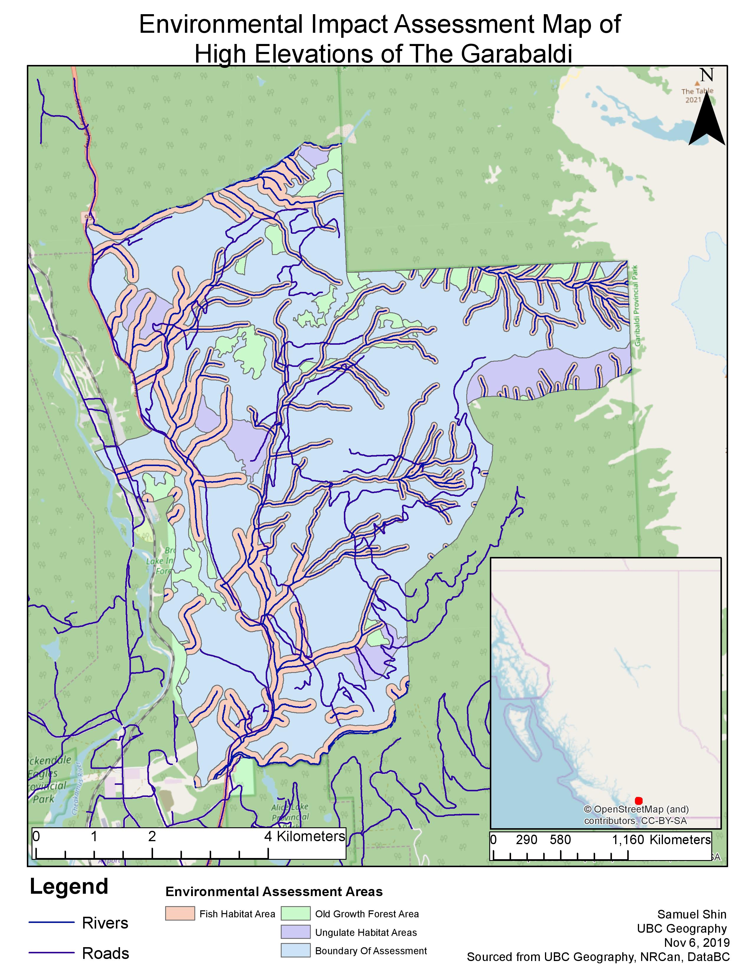
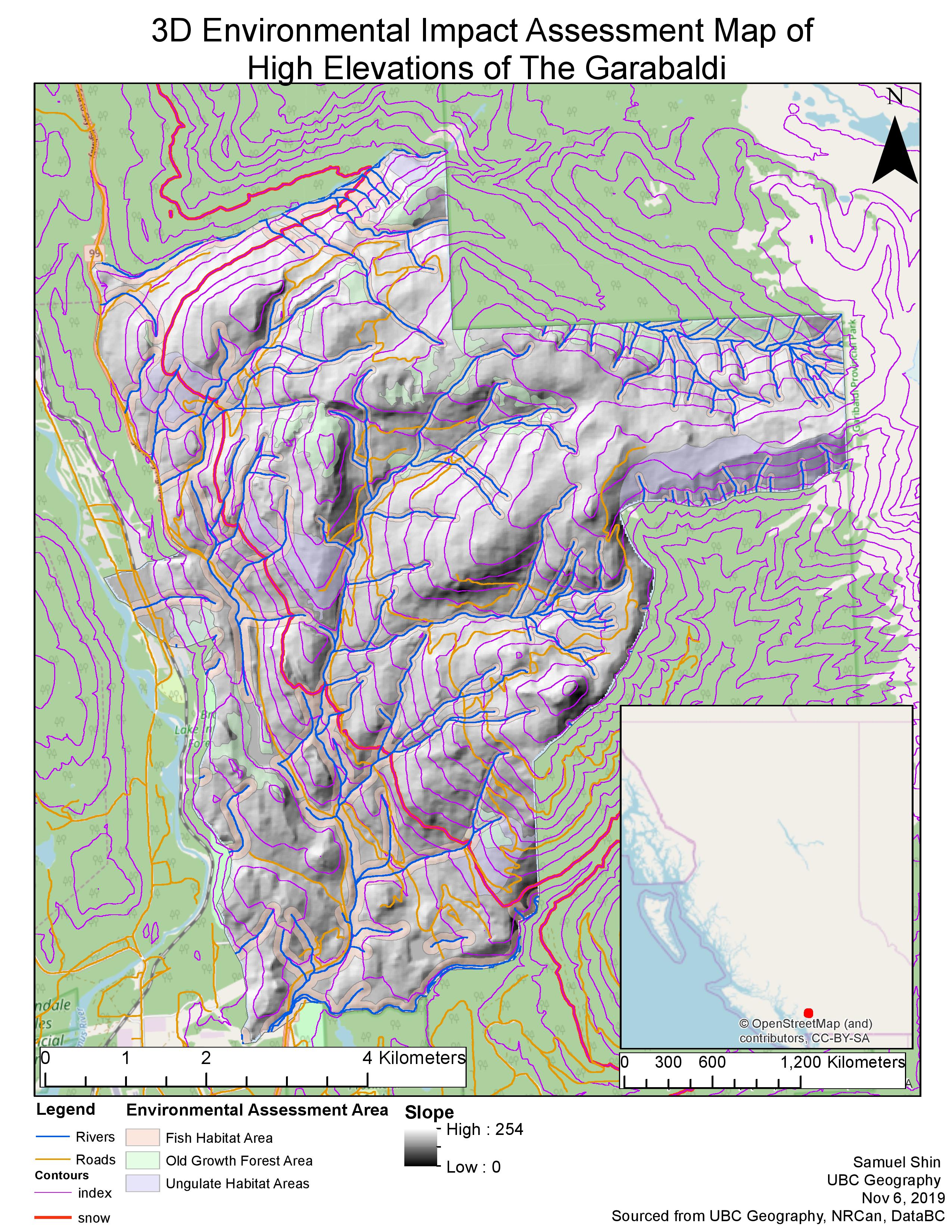
Accessing the data, we see that approximately 39% of the total areas are areas dedicated to environmental conservation of old growth trees, ungulates and fish habitats. Due to this much of the path is covered over, making no clear distinctive way for areas of ski runs/lifts. The lack of clear ways comes from the intertwining rivers and habitat areas, as many of the rivers covered many of the slopes heading down towards the bottom, there was no one clear path that one could ride down without affecting one of the environmentally protected areas. One dedicated area could be seen on the bottom left; however is underneath the potential snowfall elevation area/ Snowline. Building a ski resort on the Garibaldi may be hard to do without affecting the wildlife and protected organisms in the area. We have to take in mind, that in this case the biggest concern to the development of the Garibaldi is habitat damage, and how building a ski resort in the deep mountains will affect protected areas through construction, and heavy flow of human activity.
Some data that we got for our project area was:
- Elevations under the snow level (below 600m elevation): 31.8%
- Area of Ungulates: 7.9%
- Old growth Forest: 6.8%
- Fish habitat buffer: 28.3%
- Total affected area: 38.5%
Some of the proposed areas overlapped in specific points, causing the lower levels of total affected areas compared to the sum of all three environmental areas.
Learned how to clip between two data layers; clipped polygon lines and areas to project boundaries.
Learned to create a 3D hillshade map from existing DEM files of elevation.
Learned how to access Metadata, and the significance of accessing this information.